
Trace a York County Street Directory
A York County street directory search works best as a sequence of records, not as a list of everyone at an address. The assessment record identifies the parcel and owner of record. The map places that parcel on the street. The deed then supplies a dated transfer trail. A controlled election request may answer a narrower registration question, and a dated directory can add historic occupant evidence. Keep the source and date beside every finding, because each record answers a different question.
- Enter the street address in the county assessment search and save the parcel identifier, owner name, municipality, and available Book/Page reference.
- Open the same property in the Property Viewer. Confirm the parcel outline and road position before comparing it with another address.
- Use the deed reference, legal description, and parcel identifier to retrieve the recorded instrument and its earlier Book/Page citation.
- If an election-related purpose fits the statute, request the York County Street List through the controlled county or state process. It is not a broad household proof.
- For a past time period, check the relevant reverse or criss-cross directory and compare the dated entry with the deed and map evidence.
That handoff, address to owner to deed to voter request to history, avoids treating one record as more than it is. It also makes later corrections easier when a road label or parcel boundary changes.
York County Street Search Fields
The Assessment & Tax Claim public search and the York County Property Viewer use related but different keys. Assessment offers Basic, Advanced/Sales, and Map routes. The Property Viewer is designed to locate a mapped feature. Neither published interface verifies a full-street or ZIP-wide result filter, so begin with one address, owner, or parcel at a time.
| Tool | Field or mode | Input | Documented behavior |
|---|---|---|---|
| Assessment | Basic Search | Mode | Owner, Parcel, or Address routes. |
| Assessment | Owner Name | Two text inputs | County deed instructions say last name, then first name. |
| Assessment | Street Address | Text | Published address-search path. |
| Assessment | Parcel ID | Text | Published parcel-search path. |
| Assessment | Advanced/Sales and Map | Modes | Separate routes; field details were not verified during maintenance. |
| Property Viewer | Property Address | Autocomplete text | Returns property address and municipality context. |
| Property Viewer | Owner Information | Autocomplete text | Searches owner information or full name. |
| Property Viewer | 18-digit parcel number | Text | Parcel or lease identifier route. |
| Property Viewer | 13-digit PIDN | Text | Second parcel-identifier route. |
| Property Viewer | County Geocoder | Single-line search | Offers address suggestions and location results. |
Assessment data can lag deeds, subdivisions, permits, or court entries. If the form is unavailable, the Assessment office and Recorder both provide public terminals. Map data are public information, not a recorded plan, survey, or legal title opinion.
York County Street Directory Records by Address
Each address-keyed source has a limited role. The street directory trail begins with current property identification, then moves outward only when the question requires it. A name on a deed or owner field establishes a recorded property connection. A registration list or historical directory is a separate, date-bound record.
| Address record | Custodian | What it can establish | Access path |
|---|---|---|---|
| Assessment parcel card | Assessment & Tax Claim | Owner, property address, parcel, assessment data, and Book/Page bridge | Public portal, with office terminals if needed |
| Property Viewer | Planning Commission GIS | Parcel geometry, roads, owner mailing fields, sale clues, and district context | Free interactive map |
| Recorded instruments | Recorder of Deeds | Grantor, grantee, legal description, plans, and transfer references | Landex, SearchIQS, terminals, books, or microfilm |
| Street List | York County Elections | Specified registered-voter fields for the requested street or area | Controlled request under Election Code rules |
| Permits or code material | City or applicable municipality | Dated project or compliance evidence where held | Custodian request or a narrow RTK request |
| Reverse directory | History Center or library collection | Historic address-to-occupant leads for the relevant issue | Collection and year dependent |
Use the parcel identifier and legal description to join records. A street label alone can be too weak when a parcel was split, merged, or carried a different municipal description.
Map York County Parcels by Street
After selecting the focal property in the Property Viewer, zoom out and click surrounding parcel polygons. The County documents address, owner information, 18-digit parcel or lease number, 13-digit PIDN, and geocoder routes, plus click-to-select on the map. Record the property address, parcel identifier, owner field, and deed reference for each parcel before moving to the next one. The viewer can supply roads, parcel outlines, municipality, school, precinct, zoning, and other location context.
The default viewer does not publish a buffer, radius, or measurement selection tool. It is safer to use visual parcel boundaries and street access, then verify each chosen parcel in assessment and recorded documents. A nearby polygon might not be an adjoining property.
Note: GIS layers are useful for orientation, but York County says they are not a survey, official tax map, engineering schematic, or recorded plan.
Follow York County Street Directory Deed Trails
The Recorder research routes divide the remote deed path by period. Landex is the County route for deeds and miscellaneous documents from 1944 forward, mortgages from 1974 forward, and parcel-ID lookup from 2001 forward. SearchIQS is the County’s remote route for documents from 1749 through 1980. The county services index separately directs deeds from 1749 through 1943 to the Archives and deeds from 1943 to the present to the Recorder, so confirm the document and image path before assuming one system is complete.
For a single parcel, open the current instrument and locate the prior Book/Page reference in the deed recital after the legal description. Retrieve that prior record and repeat. The grantor is the person transferring property; the grantee is the person receiving it. For a whole street, repeat the process parcel by parcel after mapping the precise segment. Deed party indexes are not a reliable street-address browse.
Courthouse public computers are free to search. The Recorder says counter prints cost $0.50 per page, and the county deed instructions state $0.80 per page for an IQS print. Certified copies come from the courthouse.
York County Voter Street Lists
A street list is the closest documented by-street registration product, but it is a controlled election record. The county describes fields for name, residential address, mailing address, party, and active or inactive status. A selected-area or street request can be made in person or by mail. The stated electronic copy cost is $20, while printed copies are $0.50 per page. Whole-county lists follow the Department of State route.
The Street List is narrower than the Full Voter Export. The full export adds voter ID, sex, date registered, polling place, district information, voter history, last-change date, and a telephone number only if the voter supplied one. Both products remain controlled by Election Code restrictions, so extra fields do not turn either list into a household roster.
Use is limited by 25 Pa.C.S. § 1404. A requester supplies identification and a written statement that the information will be used only for elections, political activities, or law enforcement, and the material may not be posted online. The ordinary state status form is for a registrant’s own status check, not an open street browse. Nonregistrants and people using protected addresses will not make this a complete resident list.
The York County voter-list instructions show the county’s request route and the distinction between the Street List and a broader export.
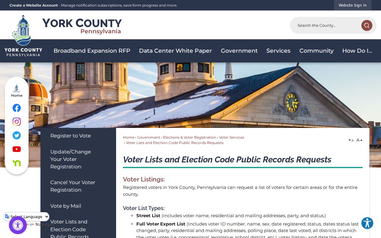
The request instructions reinforce the central limit of this record search: a voter list is a regulated registration record, not evidence of every person connected with an address.
York County Street Address Keys
A modern street number is only one key. Preserve the record’s location identifier before moving into older deeds, maps, or directories. The County’s parcel systems distinguish the property’s physical location from the owner’s correspondence address, while a recorded legal description keeps the tract identifiable across a changed number or name.
- Parcel
- A mapped unit of property with identifiers that connect assessment, GIS, and recorded documents.
- Situs address
- The physical property location used for assessment and map searching. It is not automatically the owner’s mailing address.
- UPI or PID
- The County parcel identifier. Keep it with the municipality and legal description when following a deed chain.
- Legal description
- The deed-based lot, plan, acreage, or boundary description that identifies the property beyond a street number.
- Criss-cross directory
- A dated reverse directory arranged by address, useful for a historic occupant lead where the collection covers that place and year.
A mailing address may belong to a PO box, business, trustee, estate representative, or another property. It shows where correspondence goes, not necessarily where a named owner lives.
York County Recorded Name Variations
Recorder indexing contains more than one version of a name. The Recorder warns that entries can include FKA, DBA, NKA, AKA, trustees, and partners. Search those variations when a parcel’s owner field and an older instrument do not appear to match. When Mortgage Electronic Registration Systems appears as a mortgage nominee, the Recorder cautions that MERS alone may be indexed instead of another lender name.
This is a useful comparison check, not proof that two similar names identify the same person. Anchor the search to the parcel identifier, legal description, recording reference, and transaction date before joining records.
York City Street Record Requests
For an address inside City of York, Permits & Inspections and its OpenGov application route can add a dated project or compliance lead. The research did not verify a public historical address-result screen or a complete coverage period. Give the custodian the exact address and time span, or submit a narrow Right-to-Know request for existing administrative records.
Outside City limits, use the applicable borough or township, not a County-wide assumption. Current taxes also vary by the municipality and collector. Those jurisdiction details help explain why a parcel has a York postal line but a different local-records route.
Note: An application, permit, or code entry can date a recorded activity but does not identify every person who was present at the property.
York County Street Record History
Historic York addresses need both a map and an old name search. A City study identifies North Water Street on map evidence from 1887, 1894, and 1908, then identifies North Pershing Avenue from 1933 onward. Search both names, inspect the map sheet, and preserve the municipality before treating a missing hit as a gap in the resident trail.
No authoritative countywide list of street renumberings, renamed roads, or effective dates was located. City annexation maps and the City’s street-naming table are confirmation paths for a City address. Elsewhere, use the legal description, plan reference, municipal ordinance or road record, historic deeds, and USPS address verification. For the detailed historical volumes, use the York County city directory collections rather than assuming their coverage extends across every township.
York County Street Records Across Time
York County’s historical boundary changes the record path. The County Archives reports records beginning in August 1749, and the County’s services and Archives guidance place the older deed trail there. The Archives inventory lists deed books from 1749 through 1912 and a separate 1913 through 1943 group, each described as microfilmed, scanned, and indexed. That makes the archive route especially important when a present parcel record points to a nineteenth- or early-twentieth-century transfer.
Use the York County Archives to confirm the historic index or image path, then compare a deed date with a map or a dated directory. A recorded transfer can keep the parcel trail intact, but it does not by itself show who occupied the property at every point in time.
York County Street Record Limits
A York County street directory can document an owner of record, a parcel, a recorded transfer, a regulated voter-list entry, or a dated directory appearance. It cannot prove every current resident. Utility customers, delivery records, private membership lists, and most driver or vehicle address data are not public street-directory material. The GIS and assessment routes also do not identify every occupant or ordinary household composition.
Lawful use. Use York County address records for lawful personal, civic, family-history, estate, or property research. Do not use them to stalk, harass, intimidate, or harm another person.
Protected addresses and timing gaps can change an otherwise careful result. When an official record conflicts with another source, label the conflict and confirm it with the office that holds the record.